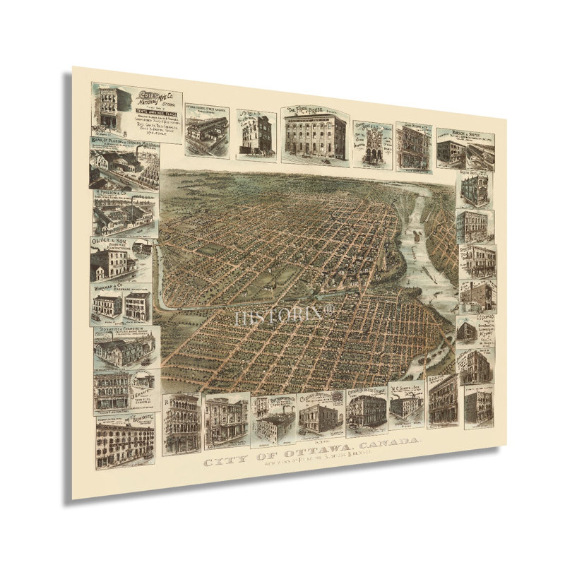
Produit et édité par la Toronto Lithographing Company dans une période de transformation, de croissance et de prospérité, cette étonnante représentation de la capitale du Canada possède une esthétique distinctive et un style unique. Les points de vue des oiseaux ont été produits dans les villes de marché en Amérique du Nord pour les résidants et les marchands potentiels et présentaient des caractéristiques civiques et géographiques importantes. Leur esthétique distinctive transporte immédiatement le spectateur dans le temps, créant un lien indélébile entre le passé et le présent. Cette carte contient de nombreux édifices remarquables dans les marges mettant en valeur les industries florissantes de fabrication et de minoterie qui attiraient des émigrants des États-Unis, d'Europe et du Canada en milieu urbain. Situé au confluent de trois grandes rivières, Ottawa a entretenu une route commerciale et de voyage vitale pendant des milliers d’années, qui se poursuit à ce jour. La reine Victoria a désigné Ottawa comme la capitale nationale en 1857, et elle a été un bastion essentiel pour les Anglais pendant la guerre de 1812. La ville a connu un marché du bois en plein essor à partir des années 1850, alimenté par de grands moulins situés sur les rives de la rivière qui allaient devenir certaines des plus grandes scieries du monde. En 1886, la ville est reliée au chemin de fer transcendantal par des lignes reliant Hull et Lachute au Québec. En 1885, Ottawa était la seule ville au Canada avec un réseau électrique qui servait tout le centre-ville, et elle était florissante pendant l'âge d'or, alors que le Canada et les États-Unis couraient vers le tournant du siècle. Cette pièce est vraiment une pièce authentique de l'histoire de la cartographie canadienne. Notre estampe numérique de qualité musée est imprimée avec de l'encre d'archives sur du papier mat épais de qualité supérieure.


 ou
ou