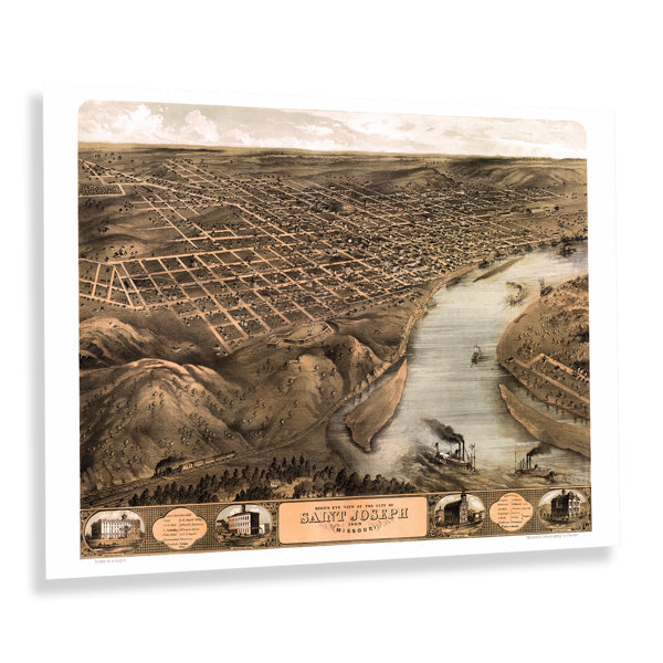
Located on the banks of the Missouri River, Saint Joseph, Missouri, was the furthest west town that could be reached by rail in the United States until rail expansion occurred after the end of the Civil War. Officially incorporated in 1843, Saint Joseph earned a reputation as a rugged frontier town that was the last point before you entered the so-called Wild West and maintained a bustling outpost that outfitted travellers as they began their journey, often to the Oregon territories. In the years following the conclusion of the Civil War, the city saw an influx of residents from across the United States and Eastern and Western Europe who established towns and communities based on shared traditions, many of which exist to this day. Saint Joseph is located across from the eastern boundary of Kansas and has a rich history, including being home to outlaw Jesse James for a brief time. Produced and published by an early adopter of the form, Albert Ruger, this bird's eye perspective was used as a way to market the town to potential residents and merchants alike and featured prominent civic features, natural attractions, and economic opportunities. Panoramic maps bear a distinct aesthetic and classic style, and Ruger's use of bold colours set his work apart from other producers of the time. Bird's eye perspectives were widely popular during the latter portions of the nineteenth century and early parts of the twentieth century. This is a unique piece of nineteenth-century American cartographical history.


 or
or